 EN
EN


Most discussions about tracking systems begin with the technology and end with an argument about energy gain. That sequence is backwards for a feasibility study. The purpose of feasibility work is to establish whether the site can physically and commercially host a tracking system, and to identify the conditions that would make the project unbuildable or uneconomic before significant design effort is spent. A single axis solar tracker is a project-engineered structure, not a catalogue product, so its feasibility depends on terrain, wind, foundation conditions, layout and operations in a way that a fixed-tilt array does not. Screening those constraints first is what turns a technical preference into a buildable single axis solar tracker project.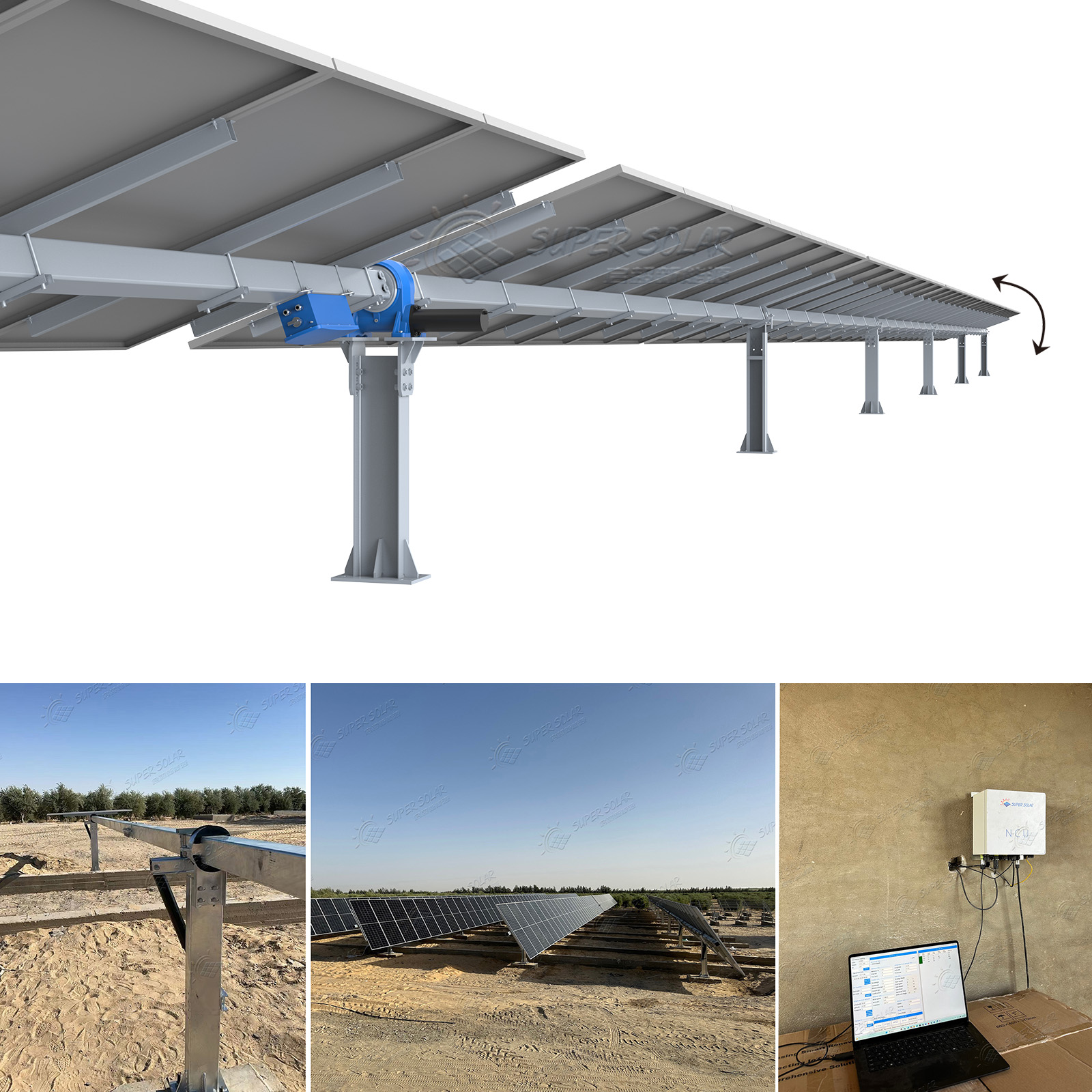
This checklist deliberately avoids repeating the mechanics of how tracking works or re-litigating the general comparison between tracking and fixed mounting, both of which are covered elsewhere in the knowledge base. Instead it concentrates on the questions a developer, EPC or technical adviser should answer during project screening: what the land will and will not accept, how the wind will be managed, how the layout will be arranged, how the asset will be operated and maintained, and what data the supplier must provide so the assessment rests on evidence rather than optimism. Each section ends with the concrete outputs that should exist at the feasibility gate.
Slope is the first constraint to test, because it drives both civil works and structural design. A tracking system designed for one configuration of terrain may tolerate modest slopes in some directions and very little in others. Products in this class have been developed with terrain adaptability in mind, with published slope capability expressed separately for north-south and east-west directions, and with steeper tolerance in the direction where grading is cheaper and less disruptive. The feasibility study should map the site's slope distribution rather than quoting an average, identify the areas that would require cut and fill, and estimate the volume of earthworks and the associated cost and drainage implications. Flat land is not the only viable site, but the cost of creating acceptable geometry must be known before a single axis solar tracker is specified.
Row spacing determines how much of the site's capacity can be installed and how much energy each row produces. Tracking changes both. Because the array moves, the spacing has to account for the geometry at the extreme positions as well as the shading that occurs in the early morning and late afternoon, and the choice of spacing trades installed capacity against yield per kilowatt. The feasibility assessment should produce a layout concept with the site's capacity, the resulting ground coverage ratio and a clear statement of the spacing assumptions used. Where terrain is uneven, rows may need to be broken, and breaking rows reduces the length over which each drive operates, which affects both the cost and the performance of a single axis solar tracking system.
Access is easy to underestimate. Construction requires routes capable of carrying delivery vehicles and installation equipment, and operations require routes that a maintenance vehicle can use throughout the asset's life without crossing rows or damaging structures. Setbacks from boundaries, roads, watercourses and neighbouring property may be dictated by regulation or by wind considerations, and they consume usable area. Drainage then becomes critical, because a graded site changes runoff patterns and a tracker row can obstruct flow. The feasibility output should include a layout showing access, setbacks and the drainage strategy, together with a note on any seasonal access limitation.
Certain site features are more disruptive to a tracking system than to a fixed array. Isolated trees, overhead lines, terrain shadows and existing structures create shading that moves throughout the day, which affects a moving array differently from a static one. Buried services and rocky outcrops constrain foundation positions, and their occurrence along a row is more problematic for tracking because rows are continuous mechanical assemblies rather than independent frames. Mapping these features at feasibility stage allows the layout to be adjusted before it becomes expensive to change.
Wind is the governing design condition for most tracking systems, both because of the loads involved and because the array can be moved into a safer position. A stow strategy is therefore central to feasibility. The assessment should establish the site's wind climate from a suitable source, distinguish between the site's observed wind speeds and the design values used for structural verification, and confirm under what conditions the control system will move the array to its stow position. The reliability of the stow function matters as much as its existence, because a stow strategy that depends on a component with a realistic probability of failure is not a strategy. Feasibility outputs should include the wind basis, the stow trigger, the stowed geometry and the verification requirement.
Non-wind weather conditions shape both the design and the operating regime. In snow regions, the tracker must tolerate snow load at the angles it can occupy, and the control strategy may need to consider snow shedding. In desert environments, sand and dust abrade surfaces and can interfere with controls and bearings, and cleaning frequency becomes an operational cost driver. In coastal and industrial sites, the corrosion environment determines material selection and coating specification, and it typically needs to be stated in terms of an exposure classification rather than a general description. Each of these conditions should be recorded at feasibility stage because each one alters the specification and the cost.
The structural screening step is about establishing whether a foundation is achievable across the site. Tracking systems are typically supported on piles or similar foundations, with published data on the number of supports required per megawatt for a reference module, and the site's geotechnical profile determines whether that foundation density can be achieved. Where rock, obstructions or groundwater interfere, the foundation design changes and the cost moves. Feasibility should therefore include the soil profile, the refusal depth and the groundwater level, plus an estimate of the support count a single axis solar tracker project will need. Super Solar's single axis solar tracker range is configured with hot-dip galvanised steel structures, defined foundation options and published support density, which gives a concrete basis for this screening rather than a general assumption.
Wind, terrain, soils and access interact. A site with gentle slopes but very high wind may need a heavier structure and a more robust stow regime; a flat site over shallow rock may need costly foundation alternatives. The useful feasibility output is a short statement of which constraint governs and how much cost or risk it adds, so the project team can decide whether the site is viable for tracking, viable only with design changes, or better served by a fixed-tilt design. It also gives the project team a common language for comparing candidate sites, which is more useful than debating technology preferences without a cost attached.
Drive and control architecture determines the operational character of the asset. Arrangements in this class typically use a low-voltage high-torque motor with a defined duty rating and environmental protection class suitable for outdoor service, communications between controllers and a supervisory system, a single-row-per-drive configuration that reduces component count, and a defined maximum rotation. Control functions normally include automatic stow for wind, a night safe position, emergency stop and motor overload protection. Feasibility work should confirm that the intended communication method suits the site, particularly where distances are long, terrain is obstructive or grid power for the control system of a single axis solar tracking system is not available.
Tracking adds mechanical and electrical equipment to an otherwise passive asset, so the operation and maintenance plan belongs in the feasibility study rather than in the commissioning phase. The plan should cover the inspection interval for mechanical components, lubrication or replacement of wearing parts, response to a drive failure, the availability of spare drives and controllers, and the labour model for the site, including whether local staff will be trained or a service contract used. The most common operational surprise on tracking projects is not a technical failure but the discovery that maintaining the drives requires skills or spares that are not readily available locally.
Monitoring data is the basis for both maintenance and performance assessment. The system should report position, drive status, alarms and energy production in a form that supports diagnosis rather than merely display, and it should log stow events so that the design assumptions can be verified over the first operating seasons. Reliability should be assessed component by component, with the drives, bearings and control electronics treated as the items with finite life, and with a defined inspection regime for structural components. Recording the actual failure history over the first years is the fastest route to a credible maintenance budget.
Where the site is remote, the operational model changes. Access may be seasonal, repairs may require parts to be shipped over long distances, and any design choice that increases the number of wearing components increases the operational burden. On such sites a smaller number of larger drive units, or a configuration with fewer moving parts, may be preferable to a nominally more efficient arrangement. Feasibility should quantify the cost of an intervention, because a maintenance regime that looks economical at feasibility can become unaffordable once travel and downtime are included.
Request a project-specific data package rather than a brochure. The essential items are the structural design assumptions and the load cases the structure is verified against, the foundation options and the required support density for a reference module, the terrain and slope capability with the direction in which it applies, the drive and control specification including protection class and duty rating, the stow and protection functions, the control and communication architecture, the design life of the structure and of the moving components, and the documentation that will be supplied for approval.
Any yield estimate should come with its assumptions, because the value of tracking depends on them. The model should state the irradiation data source and period, the terrain and horizon shading assumptions, the row spacing and ground coverage ratio, the tracking algorithm and its limits, the availability assumption and the loss assumptions. Where a comparison with a fixed-tilt design is presented, both cases should be modelled on the same irradiance data and the same layout assumptions, since a comparison that changes two variables at once measures neither.
Assemble the outputs into a single decision gate: site slope mapping and earthwork estimate, layout concept with capacity and spacing assumptions, access and drainage plan, wind basis with stow strategy, geotechnical profile with foundation feasibility, corrosion and weather exposure classification, drive and control specification, operation and maintenance plan with spares strategy, and the supplier's data package with simulation assumptions. If any of those items is missing, the project is not yet at a decision gate, and proceeding to detailed design will transfer the missing risk into construction. Super Solar provides free project evaluation and project-based engineering design for tracking structures, covering structural calculation, layout support and drawings, and supplies samples and technical documentation so that the feasibility case can be closed on evidence.
Finally, record the decision and its basis. Whether the project proceeds with tracking, proceeds with fixed tilt, or proceeds with a modified scope, the reasoning and the data behind it should be retained. Most tracking projects that disappoint do so not because the technology failed but because a constraint that was identified at feasibility was later forgotten during detailed design. A written decision record is the cheapest safeguard available. Keeping the decision record with the design file means that a change of personnel does not undo an assessment that was made on evidence.
Tracking becomes difficult where slopes are steep enough to require extensive grading, where wind exposure is severe enough to demand a disproportionately heavy structure, where shallow rock or obstructions prevent the required foundation density, or where access is so constrained that construction and maintenance are impractical. None of these conditions is automatically fatal, but each one changes the cost and the risk profile enough to justify re-screening. The feasibility decision for a single axis solar tracker should be based on which constraint governs, not on whether any constraint exists.
Fixed-tilt structures tolerate irregular terrain more readily because each frame is smaller and independent, so a broken or stepped layout has limited consequences. Tracking rows are continuous mechanical assemblies, so uneven terrain complicates alignment, drive positioning and foundation placement across the whole row. Gentle, consistent slopes can often be accommodated, and published slope capability typically differs by direction, but steeper or irregular ground usually favours either extensive grading or a fixed-tilt solution. The trade-off should be quantified as earthwork cost against energy gain. Where grading is unavoidable, its cost and its drainage consequences should be priced into the comparison rather than treated as site overhead.
It must detect the condition and move the array to a stow position that reduces loading, then hold that position until conditions allow normal operation. The reliability of that behaviour is a design requirement, not a feature: the stow function should be defined with a trigger condition, a defined stowed geometry and a defined failure mode, and the structural design should be checked for the states the array can occupy, including a partial position during a gust. A stow strategy that depends on an unreliable component is not adequate mitigation for an exposed site.
Ask for the structural design assumptions and load cases, the foundation options with required support density for a reference module, the terrain and slope capability by direction, the drive and control specification with protection class and duty rating, the stow and protection functions, the communication architecture, the design life of structure and moving components, and the approval documentation that will be provided. Add the simulation assumptions underlying any yield estimate, so that the energy case can be checked independently rather than accepted on assertion.
 Hot News
2025-11-03
2025-10-22
2025-01-24
2024-06-12
2024-06-12